Negombo, one of the most culturally vibrant cities on Sri Lanka’s western coast, could also be said to be the ultimate paradise of Sri Lankan tourism. However, the reality is darker than we thought, especially for Negombo’s people. Rising sea levels, coastal erosion, and increased flooding are slowly reshaping the landscape and threatening the lives and livelihoods of Negombo’s people.
The city’s unique position at the estuary of the Negombo Lagoon, combined with its low elevation, makes it particularly susceptible to the creeping impacts of global warming. But why Negombo? Why is this city so vulnerable? Let me explain everything from the beginning.
Negombo Geographic Location Population and Economy
Negombo is a coastal city on Sri Lanka’s western coast in the Gampaha District. It has a shoreline extending around five kilometers along the Indian Ocean and is positioned right at the estuary of the famous Negombo Lagoon.
Negombo is relatively flat, with an elevation ranging between -1.0 meters and 3.5 meters above sea level. This means large portions of the city are either at or below sea level. This geographical positioning leaves it highly exposed to rising seas and storm surges. Any increase in water levels, whether from seasonal tides or long-term climate shifts, can quickly cause flooding and erosion, making life along the coast more dangerous with each passing year.
Being at the mouth of a lagoon might seem like an advantage and it supports local fishing and provides beautiful views. Still, it also acts as a funnel for rising waters, directing floods into the city’s heart.
Population and Economy
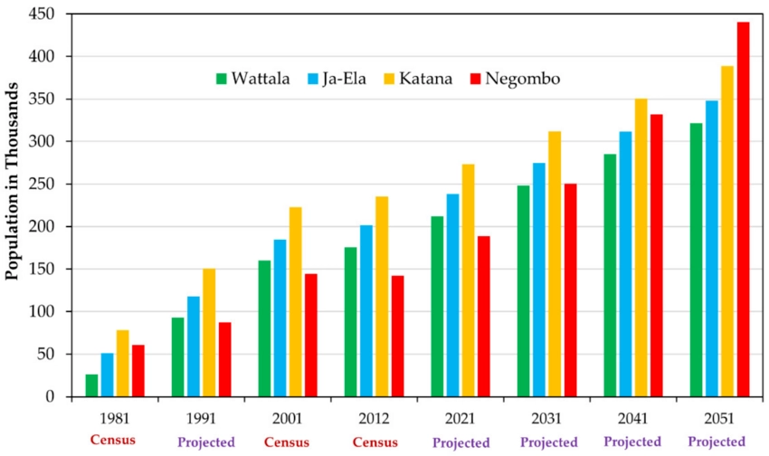
Negombo is a growing urban center with a population that exceeded 142,136 people by 2024, and the city’s growth rate continues at miore than 2% annually. This bump in population is concentrated in coastal areas, amplifying the strain on the city’s ability to cope with rising seas and frequent floods.

From researchgate.net
Negombo’s economy is heavily tied to coastal resources. Fishing and tourism are the lifeblood of many communities here. Trade also plays a critical role, with the city serving as a regional commercial center. However, the industries that support the economy are at constant risk. Flooding, rising sea levels, and erosion threaten the physical infrastructure of businesses, homes, and public spaces, making it harder for these sectors to thrive in the face of worsening climate conditions.
Climate Change Risk and Vulnerability of Ngombo: Impacts of Sea Level Rise and Coastal Erosion
The city’s low elevation, with much of it at or even below sea level, makes it extremely vulnerable to the gradual rise of the ocean. Each year, the coastline creeps inward. Erosion eats away at the shoreline, damaging property but also displacing entire communities that rely on these areas for their livelihoods. With the city nestled at the mouth of the Negombo Lagoon, any rise in sea level quickly leads to flooding, as there’s little room for the water to go into the city itself.
The 2004 tsunami was a reminder of how quickly disaster can strike. The tsunami’s impact was felt nationwide, and it also revealed just how exposed Negombo’s coastline is to large-scale flooding. Large sections of the coastal belt were hit hard, with homes, businesses, and critical infrastructure washed away. Even though this was an extraordinary event, it highlighted the city’s vulnerability to water-related disasters. What makes matters worse today is the rapid urbanization Negombo has experienced in the years since.
Health and Environmental Risks
When heavy rains or storm surges, flood streets become a health hazard, fostering outbreaks of illnesses like diarrhea and dengue fever. Poor drainage systems and flooding make these health threats more severe and widespread. Residents, particularly those in slum areas, face heightened exposure to these diseases, as their communities often lack the resources and infrastructure to deal with frequent flooding.
Sea water intrusion into the lagoon and inland water bodies has already begun to change the local ecosystems. Saltwater seeps into freshwater systems, making it difficult for many plant and animal species to survive. The biodiversity that once thrived in the lagoon and surrounding areas is slowly decreasing, and with it, the livelihoods of those who depend on fishing and farming.
Flooding also increases sedimentation, clogs waterways, and disrupts the natural flow of water. This not only leads to more frequent floods but also destroys agricultural lands and reduces the productivity of fisheries.
Coastal Fishery and Agriculture in Sri Lanka
The coastal fishery sector in Sri Lanka is the backbone of the country’s seafood industry. Coastal fishing accounts for 75% of Sri Lanka’s total fish yield. With 2,626 fishing villages spread across the island, including the over 1,337 fishing villages dot the coastline.
In these villages, where nearly 144,520 households rely on the trade, around 132,600 families are involved in marine fishing, while another 11,920 focus on inland fisheries.
Over 250,000 people work in this sector on the water, while another 100,000 help behind the scenes. Whether mending nets, processing catches, or selling the day’s haul at markets. The marine sector alone provides jobs for 85% of these workers. These fishermen head out daily to catch various aquatic species, including reef fish that comprise around 15% of marine landings.
Coastal fisheries are not only vital for domestic consumption but also make a significant contribution to Sri Lanka’s economy through exports. In 2019, inland and aquaculture fish production reached 90,340 metric tons. The total export volume of seafood and fishery products amounted to 28,771 metric tons, generating US$81.3 million in foreign exchange earnings.
Coastal and marine fisheries, the powerhouses of the seafood industry, account for a whopping 88% of the total fish production. Their dominance in both local and international markets further solidifies their economic importance.
Sri Lanka boasts 752 minor fish landing sites, ten principal fishery harbors, and 19 anchorages along its coast, so the infrastructure supporting this industry is vast. If you want to read more about Negombo Fish Market, we’ve got you covered.

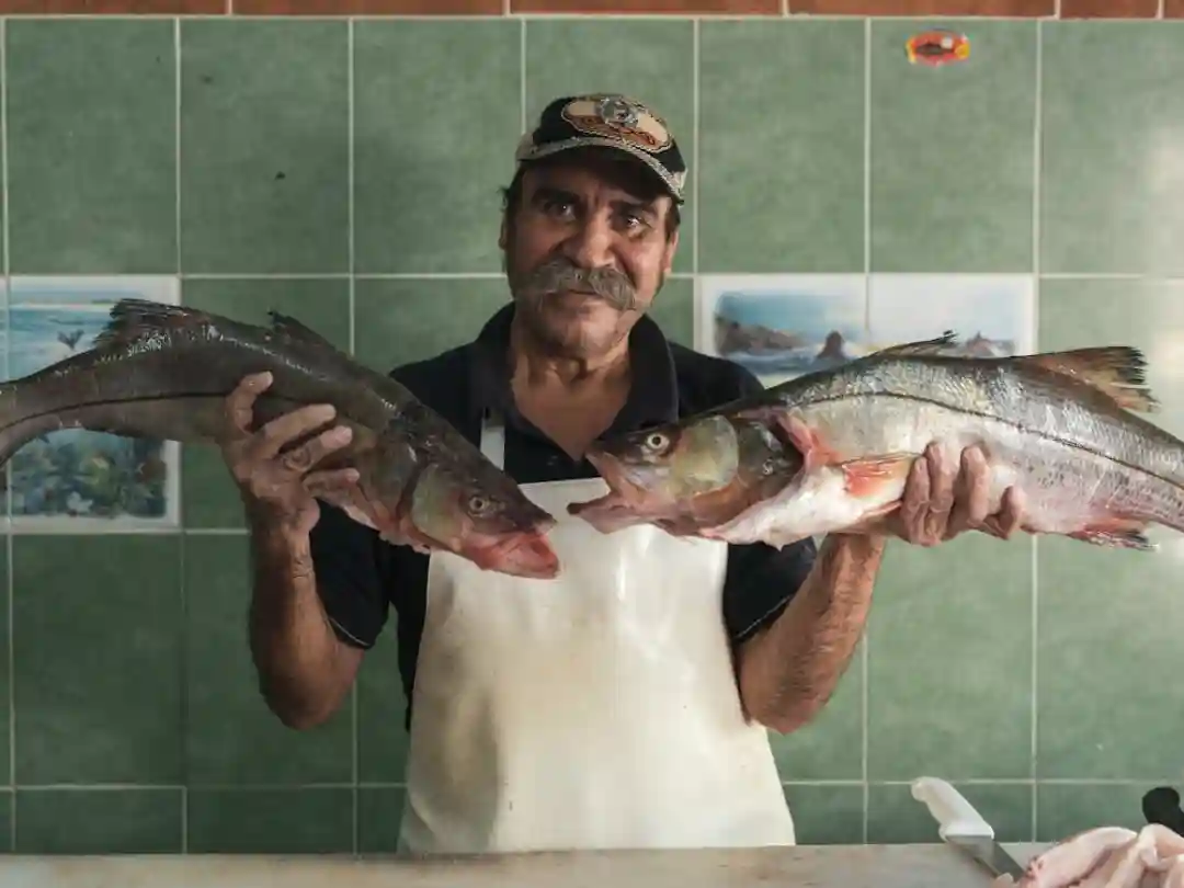
A Negombo fisherman proudly shows his catch of two fish.- Los Muertos Crew
Mineral Resources in Coastal Areas
Sri Lanka’s coastal areas are known for their gorgeous beaches and, thriving fisheries, and their rich deposits of minerals. These coastal regions contain a variety of quaternary deposits, including sands, sandstone, quartz, gravels, red earth, and inland coral deposits. Among the most valuable resources are heavy mineral sands found in significant quantities along the coastlines from Kokilai to Pulmodi, Kuderamali, Trincomalee, Beruwala, and Hambantota. These mineral sands are rich in ilmenite, rutile, and zircon, crucial for industries like ceramics, paint production, and electronics manufacturing.
Salt is another key resource extracted from coastal areas, especially in regions like Puttalam, Mannar, Elephant Pass, and Hambantota. Salt production plays a vital role in both the local economy and national exports. Similarly, limestone deposits, mainly Miocene limestone, found in Puttalam, Mullithevu, and Jaffna Peninsula, are fundamental for the construction and cement industries.
Petroleum, natural gas, and shale deposits are thought to be present offshore, although they remain largely unexplored. The potential discovery and extraction of these resources could open up a whole new chapter in the country’s energy sector.
Sensitive Habitats in Coastal Zones

Mangroves and coral reefs thriving in the coastal waters of Negombo, Sri Lanka. – lakpura.com
Mangroves and coral reefs are nature’s frontline defenders when protecting coastal environments. Mangroves, with their dense root systems, act like natural barriers, trapping sediment and stabilizing shorelines. Their unique ability to grow in saline conditions allows them to thrive where other plants can’t, creating a buffer that protects coastal areas from storm surges and tidal waves.
By reducing the force of waves before they reach the shore, mangroves help prevent erosion, a growing concern in places like Negombo, where rising sea levels steadily wear away the coastline. Many fish, crustaceans, and mollusks rely on the complex root structures of mangroves for shelter and breeding grounds, making them indispensable to the health of marine life.
Similarly, coral reefs are crucial in protecting coastlines and fostering marine biodiversity. These underwater structures, with their unique ability to minimize coastal erosion, act as natural wave breakers, absorbing the energy of waves before they reach the shore. By doing so, coral reefs help to minimize coastal erosion and reduce the impact of storms, providing a sense of reassurance and security.
Beyond their protective functions, coral reefs provide habitats for countless marine species, from colorful fish to delicate invertebrates, contributing to the rich biodiversity of Sri Lanka’s coastal waters.
Seagrass Beds and Marine Life
Seagrass beds may not be as visually striking as coral reefs, but their ecological importance is undeniable. These underwater meadows play a crucial role in binding sediments, which helps prevent coastal erosion, a significant issue for Sri Lanka’s coastal zones.
The roots and leaves of seagrass trap and stabilize sediment, keeping the seafloor intact and reducing the likelihood of erosion caused by currents and waves. In this way, seagrass beds act like an anchor for the coastline, much like mangroves do on land.
In addition to protecting against erosion, seagrass beds provide food and habitat for a wide range of marine creatures. From sea turtles grazing on the grasses to small fish and invertebrates hiding among the blades, seagrass beds support diverse marine life.
These habitats are especially important for species that are economically valuable, like fish and shellfish, which many coastal communities rely on for their livelihoods. The economic value of seagrass beds is something that needs to be appreciated and supported.
In Sri Lanka, the most prominent seagrass beds are found in the Gulf of Mannar, Palk Bay, and Palk Strait, as well as in basin estuaries and lagoons. These seagrass ecosystems not only contribute to biodiversity but also play a vital role in protecting the coastline from the ever-growing threat of climate change.

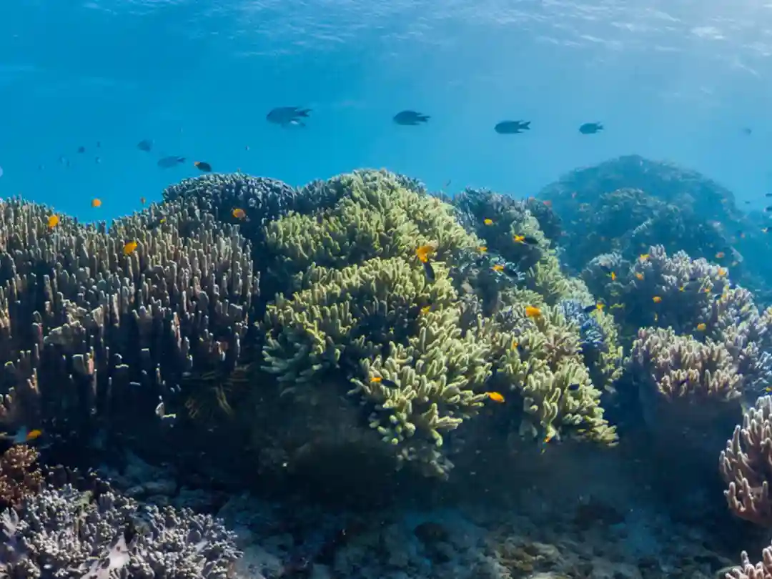
A tourist explores the vibrant coral reef during a dive near Negombo, Sri Lanka.- Image by freepik
Climate Change Impacts on Coastal Erosion and Temperature Rise
The Intergovernmental Panel on Climate Change (IPCC) has projected significant sea level rises that pose serious risks to coastal areas like Negombo. According to their estimates, global sea levels are expected to rise by 0.2 meters by 2050 and 0.5 meters by 2100. These numbers may seem small, but for a city like Negombo, where much of the land sits at or below sea level, this rise can be devastating.
As the ocean encroaches further inland, the result will be an accelerated coastline retreat estimated at around 25 meters by 2100. This retreat is not just a geographical shift but a direct threat to the homes, infrastructure, and livelihoods of the people living along Negombo’s coast. It also endangers the economic sectors such as fishing and tourism that rely on the coastal environment.
Coastal erosion is another problem that goes hand-in-hand with sea level rise, and it doesn’t happen uniformly. The rates of erosion can vary widely depending on several factors, such as wind patterns, wave activity, and the geomorphology of the land.
In some areas, the erosion rate may be as low as 1 meter per year, but it can soar to 13 meters annually in more critical zones. The speed and severity of erosion are also influenced by human activities, like sand mining and coastal construction, which disrupt the natural barriers that would otherwise help to slow the process. Negombo, with its increasing urban development and heavy reliance on its coastal resources, faces the challenge of not only losing land but also seeing its entire way of life reshaped by these environmental forces.
Global Temperature Rise and Historical Data
The rise in global surface temperatures is another key driver behind these alarming changes. Over the past century, global temperatures have steadily climbed, with the most dramatic increase occurring between 1910 and 1945, during which the average temperature rose by about 0.5°C.
While that may sound modest, even slight temperature increases can have far-reaching consequences, especially for coastal cities like Negombo. Warmer temperatures contribute to the melting of polar ice caps and glaciers, adding more water to the oceans and accelerating sea level rise.
Additionally, warmer air holds more moisture, leading to more intense and frequent storms, exacerbating coastal erosion and flooding.
For Negombo, the implications of the rise in global temperature are clear. The warmer it gets, the more severe the impacts on the coastline.
Not only does the rising sea level threaten to submerge parts of the city, but the increased storm activity brought on by higher global temperatures means that the city will face more frequent and more destructive weather events.
Over time, these combined factors could lead to the displacement of coastal communities, the destruction of critical infrastructure, and a severe strain on the local economy. If global warming continues at its current pace, the long-term future of coastal cities like Negombo hangs in the balance, making immediate action on climate adaptation more crucial than ever.
Ecological and Socioeconomic Impacts of Climate Change
Mangrove forests are crucial ecosystems, especially in coastal areas like Negombo, where they act as natural buffers against storms and rising sea levels. However, as the sea encroaches upon the land, the mangroves are beginning to disappear.
One of the key components of mangrove survival, pneumatophores (the aerial roots that allow mangrove trees to breathe in waterlogged soil), are highly sensitive to sea-level changes.
The loss of mangroves is not just a reduction in their numbers but a severe blow to the nursery habitats for many economically important fish and shellfish species. This interconnected ecosystem is under threat.
The rising sea levels also pose a direct threat to areas like Munnakkarai islet, which plays an integral role in Negombo’s fisheries. By 2100, the islet is projected to experience land losses of 18.21% under mild sea-level rise scenarios, but in more extreme cases, this figure could rise to 27.54% or even 42.20%.
This shrinking territory spells trouble for a region that relies heavily on its land for fisheries. Coastal erosion and flooding will directly reduce the areas available for fishing operations, docking facilities, and processing units, severely straining the economic activities tied to the sea.
The potential for species loss is a direct hit to the livelihoods of thousands of fishermen and their families. Entire coastal communities risk being displaced as rising waters claim both the land they live on and the resources they depend on.
